Mega landslides in the Solar System
Mass wasting processes are the most common surface processes in the Solar System, together with impact cratering. All is needed is a topographic relief and gravity. When right conditions are met, materials (rocks and regolith) forming the slopes will break loose and move downhill.
There are different types of mass wasting. Amongst them, there is a category of landslides that has been defying scientists' understanding: these are long-runout landslides and they are common deposits across the Solar System. These impressive landslides are characterised by their large volumes (> 106 m3, that is 400 Olympic size swimming pools) and the ability to move away from the head scarp at velocities that can exceed 100 km/h for up to tens of km, along sub-horizontal surfaces.
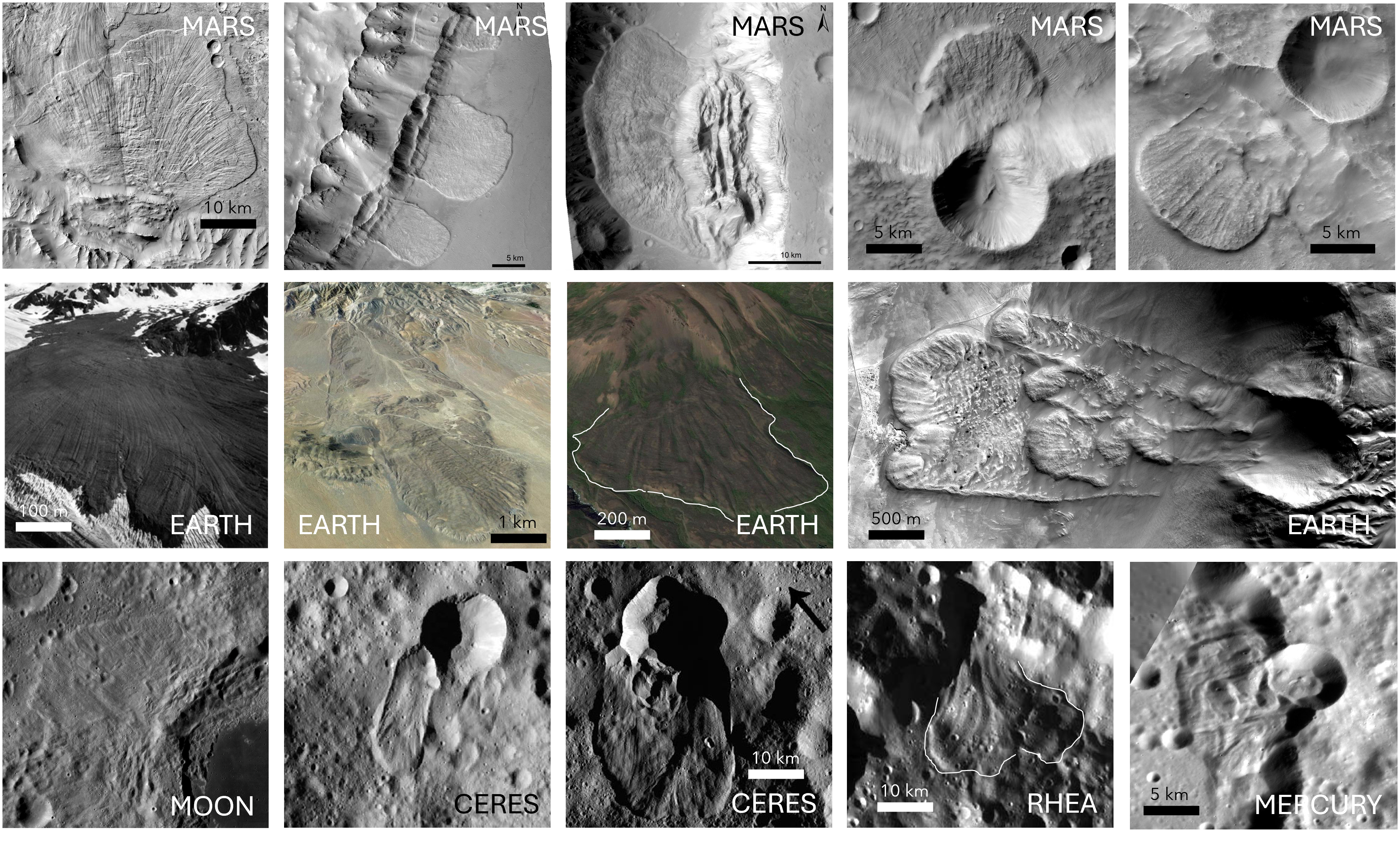
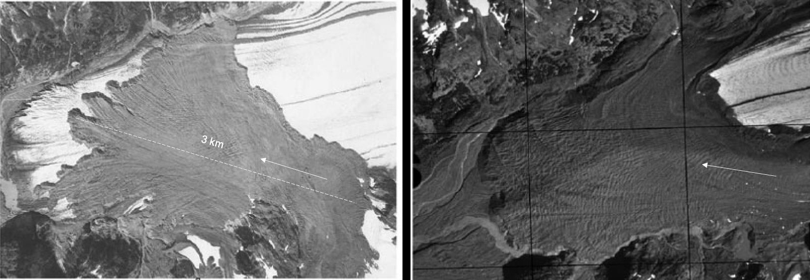
First described in the European Alps by the Austrian geologist A. Heim in the late 19th century, some of the early notable terrestrial studies were the 21-km-long Saidmarreh landslide (Iran) and the 5-km-long Sherman Glacier landslide (Alaska). But it's their discovery on Mars and the Moon in the early 70's that brought renewed attention to long-runout landslides. This is because understanding the origin of their hypermobility may have implications for understanding the geological and climatic setting of other planetary bodies.
For example, the morphological similarity between the longitudinal ridges (the linear structures visible on the surface of the landslides and that extend parallel to the direction of motion) in martian long-runout landslides and those in terrestrial landslides emplaced on glaciers (such as the Sherman Glacier landslide) has been used to suggest that martian landslides were also emplaced on glaciers (note that at present solid ice on Mars is found at the poles and in the subsurface at high latitudes). The ages of martian long-runount landslides span across almost the entire geological history of Mars (hundreds of millions to billions years old), so if they really represent evidence of the past existence of glaciers on Mars, it would have huge impact in our current knowledge of martian climatic evolution.
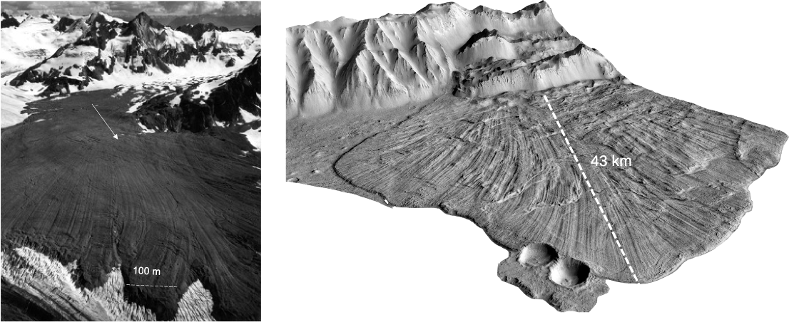
However, there are two objections to make against this hypothesis: first of all, terrestrial landslides on glaciers are quickly destroyed by glacier dynamics, whereas martian landslides are incredibly well-preserved; second, longitudinal ridges are also found in terrestrial volcanic landslides and in long-runout landslides that were not emplaced on ice, for example, the El Magnifico landslide in Northern Atacama on Earth and the Tsiolkovskiy crater landslide on the Moon.
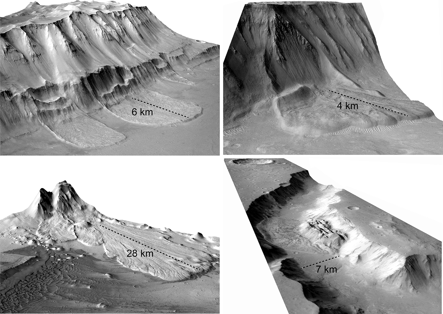
If initially the search for the explanation of the mobility of long-runout landslides was directed towards finding a universal mechanism, in light of the varied geological and environmental contexts in which long-runout landslides are found, the possibility that more than one mechanism might be available has become welcomed in the research communinity. Many advances in our understanding of these enigmatic landslides have been made in the past thirty years or so. Contributions have come from areas of research such as the physics of granular flows, computational modelling, fault mechanics, and planetary sciences. Studying long runout landslides on other planetary bodies has the advantage that their geomorphological record is well-preserved, because of the reduced erosion rates. If you then have high resolution imagery available, this becomes a powerful asset. Thanks to the NASA Mars Reconnaissance Orbiter mission, we have now a 6 m/px global and repetitive coverage of the martian surface, and this allows the production of 20 m/px digital elevation models to be used for detailed morphometric analysis of long-runout landslides and their morphological features.
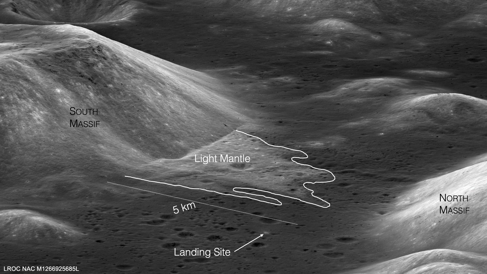
However, direct investigations of these huge landslide deposits (that is going in the field to map their structures) are crucial as these observations represent the benchmarks against which all the models and hypotheses are tested. There is only one extraterrestrial landslide that have been explored by humans and this is the so-called Light mantle deposit on the Moon. The Light Mantle is a 5-km-long landslide deposit in Taurus-Littrow Valley and it was one of the primary geological targets of the Apollo 17 mission in 1972. During the mission, a core of the top 70 cm of the deposit was collected and brought back to Earth for analysis. However, NASA decided to keep the core sealed and to wait for when more advanced technology would have been available. The top part of the core was opened in 2019 and the lower part in 2022 (watch the video here).
On Earth, only ancient (that is those up to few thousands years old) long-runout landslides with longitudinal ridges are preserved in the terrestrial geomorphological record and these preserved deposits can be much more voluminous than those observed recently. Could these catastrophic landslides happen again in the future? To answer this question, understanding their origin will be fundamental to assessing their potential hazard.