Overview.
Long-runout landslides with longitudinal ridges are amongst the most catastrophic type of mass movements and the least understood. Only ancient (i.e., ~60 ka/7 ka) long-runout landslides with longitudinal ridges are preserved in the terrestrial geomorphological record, whereas present-day ones are only seen developing over glaciers in remote mountain areas and their deposits are dismantled in few years by the movement of the glaciers. These ancient, preserved deposits can be up to an order of magnitude more voluminous than those observed recently. The geomorphological record of long-runout landslides with longitudinal ridges is critical to understanding where, when, and how these catastrophic events occurred, thus critical to addressing a key question in hazard assessment: how likely events of similar magnitude to those of the past are likely to occur in the future? Despite their hazard potential, long-runout landslides with longitudinal ridges remain largely neglected in the terrestrial research community.
Accomplishing this project will have fundamental implications in assessing future landscape responses, as it aims to understand whether the formation of long-runout landslides with longitudinal ridges is dependent or independent on climatic and environmental conditions. Iceland represents an ideal site to conduct such investigation, as it is a unique region for its high spatial density of well-preserved landslides with longitudinal ridges, not seen anywhere else on Earth.

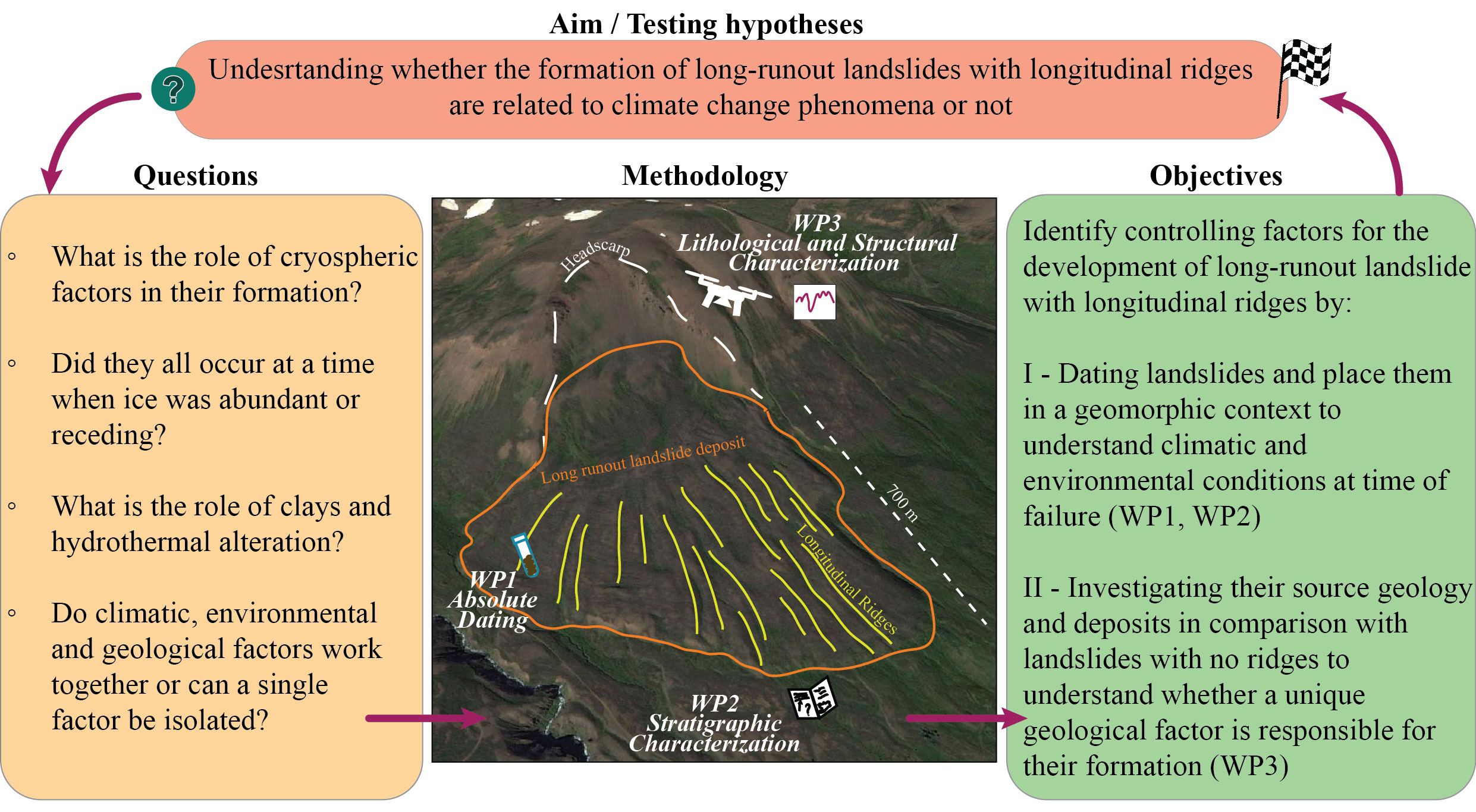
Objectives and proposed actions.
Understanding of the chronology of rock slope failure occurrence during deglaciation remains a major geomorphological issue worldwide.
Chronological data are a major need, as well as studies that consider the regional complexity of slope instability in deglaciated areas.
The RIDGES project centres around this important question: are long-runout landslides with longitudinal ridges related to climate change phenomena,
i.e., deglaciation and permafrost degradation? The project has two objectives:
1. Dating landslides and place them and place them in a geomorphological context to understand climatic and environmental conditions at time of failure.
2. Investigating the source geology and the deposits to understand geological factors responsible for their formation.
The objectives will be accomplished using three Work Packages:
WP1. Absolute dating of selected landslides with longitudinal ridges.
WP2. Stratigraphic characterization of selected landslides with longitudinal ridges.
WP3. Geological and structural context characterization of landslides with and without ridges.
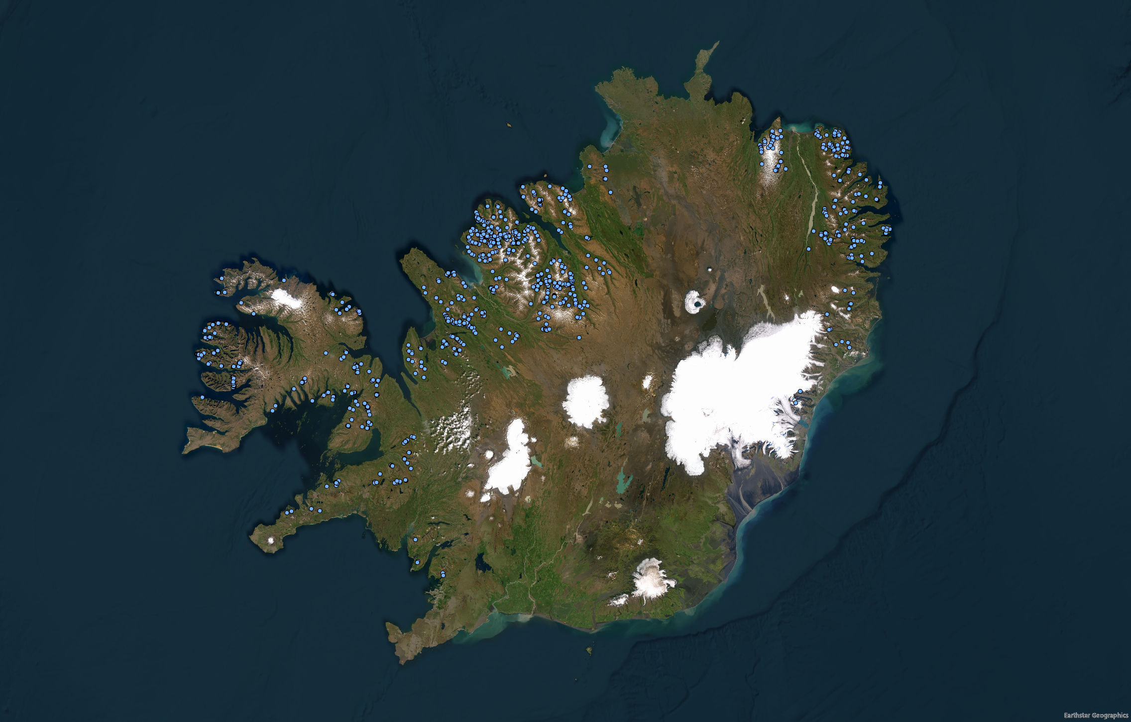
1. Catalogue of large rock slope failures in Iceland.
Mapping
Preliminary mapping of landslide with longitudinal ridges in Iceland was done in preparation for the writing of the proposal. I am currently working on finalizing it. The dataset will be made available as shapefile and kmz file.
2. Case studies of landslides with longitudinal ridges in Iceland.
Dalvík landslide
The landslide is located 1 km northwest of the town of Dalvík in the Tröllaskagi peninsula. The Dalvík landslide is a good example of a well-preserved long-runout landslide with longitudinal ridges in Iceland. The landslide has a horizontal runout (L) of 1.210 km and a vertical drop (H) of 0.480 km, resulting in a H=L ratio of 0.396.
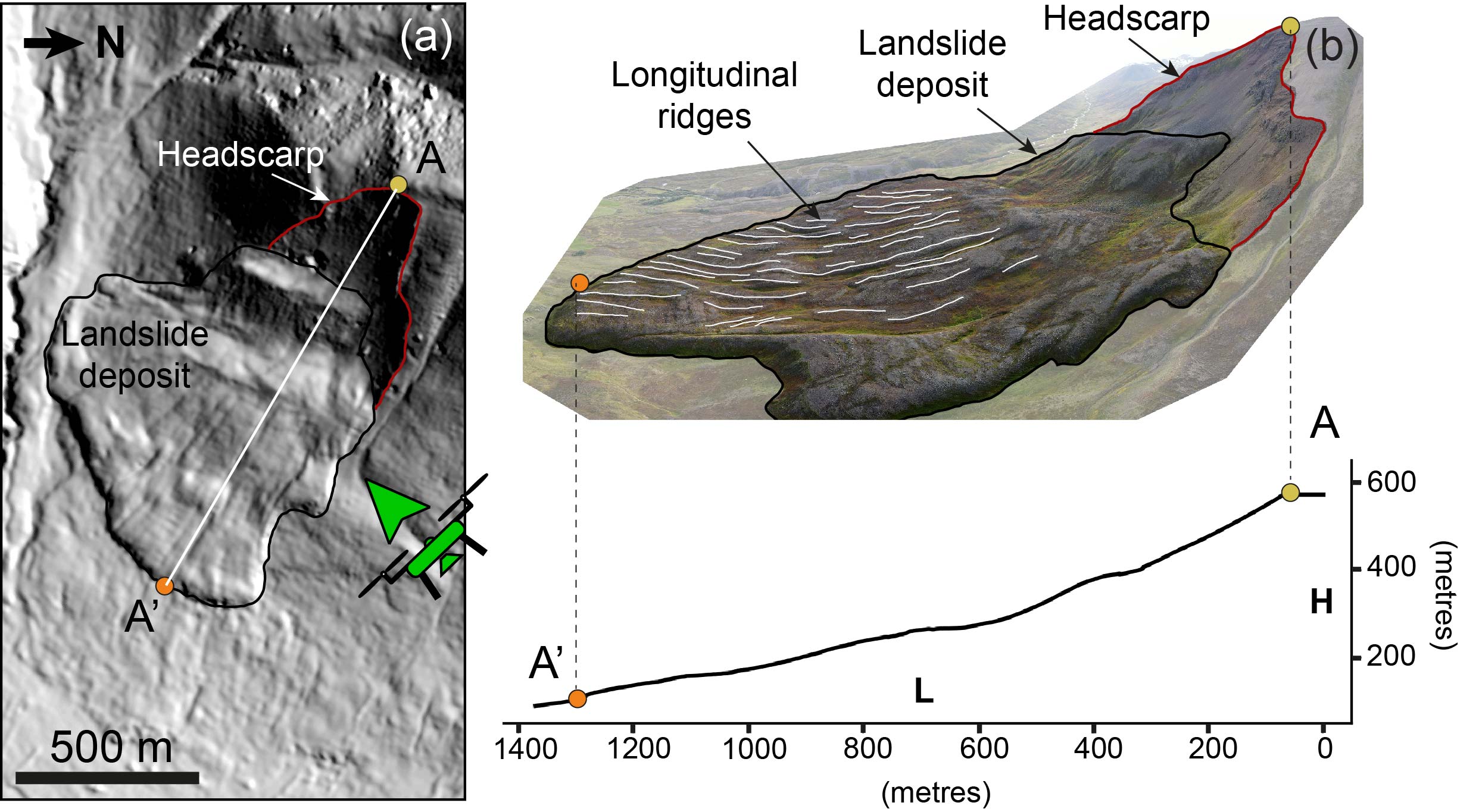
This was the pilot study that led to the proposal:
Long-runout landslides with associated longitudinal ridges in Iceland as
analogues of Martian landslide depositsSoon
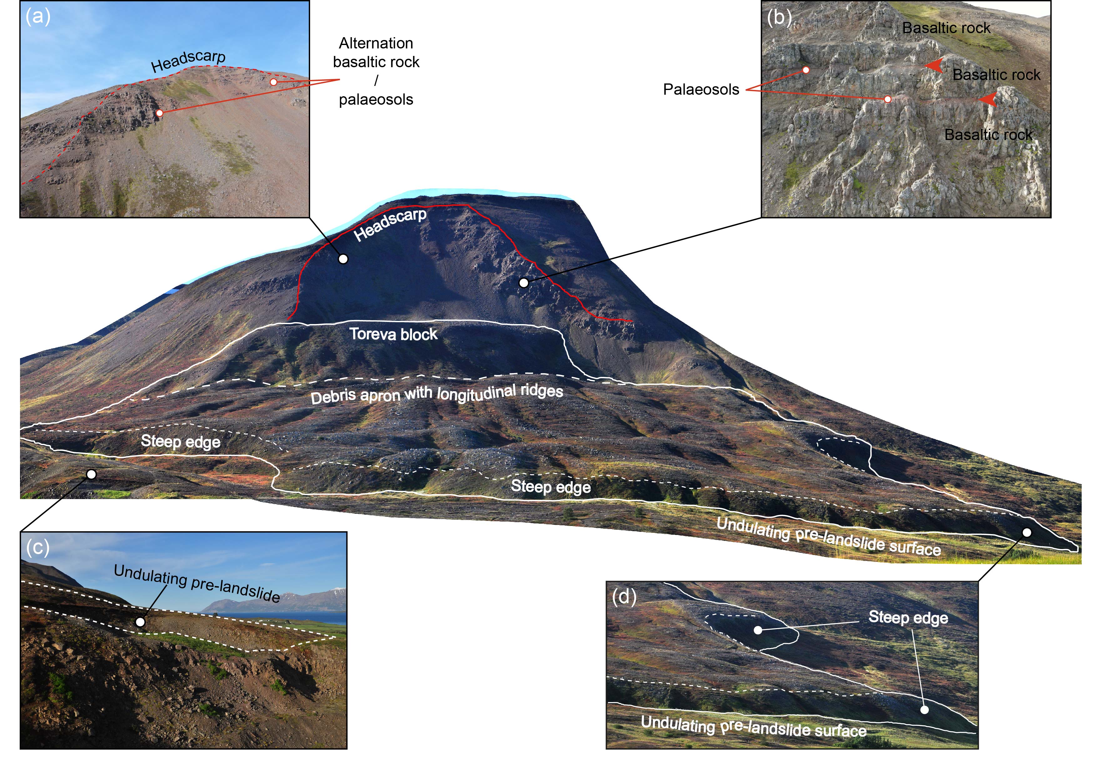
3. Dating landslide deposits.
Soon
...